 Ahead, as you continue, the craggy top of Kentmere Pike, bulky Harter Fell and Brantstree dramatically fill the skyline, and up through this wild head climbs Gatescarth Pass, a rugged track, the old way to Mardale and Haweswater.
Picturesque farms lie scattered through out the dale and half way along stands St Mary’s Church. It had been closed for refurbishment but now the interior walls have been whitewashed, the woodwork varnished and the grass in the churchyard cut. Much of the work was done by the families that live in the valley, in time for a wedding, an exciting happening in this lovely dale.
Opposite the church stands the community hall, once the valley school. Beside it a large parking area has been provided, two picnic tables and a loo - exceedingly well looked after with a vase of flowers on the window cill.

- From the parking area, walk on along the lane for a short way to take a wide left turn. Descend the track to cross the River Sprint and bear right to pass through a gate onto an access track that winds through the meadows and leads to the first dwelling, Hollin Root. Just before the house, climb the slope on the left. Pass through a waymarked gate onto a wide walled ancient track, which winds left. It then rises gently, taking you above Spring Wood, the haunt of that now rare bird, the cuckoo. It is well reinforced all the way to the fell wall and a gate, which gives onto open access moorland beyond. Go ahead on the continuing track, which rises parallel with a wall to your left. Follow the grassy way as it, and the wall, curve right.
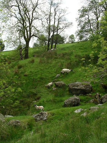
- Stroll on up over the heather moorland, through a kissing gate and, still keeping beside the wall, look right to see several stone grouse butts. Carry on, to where the grassy trod winds sharp right, with a waymark fifty meters along it. Notice the cotton grass, waving in the breeze reminding you that this is high boggy moorland. Another waymark soon directs you left to go through a gate in the next wall, with a tumbledown wooden sheepfold, beyond and to your left. Keep on the generally dry track as it rises and falls, with glimpses of Skeggles Water behind some rare low craggy outcrops. Cross the tractor bridge over Skeggleswater Dike and on through the waymarked gate. The path then winds and descends to a rather muddy junction of tracks. Pause here to look down over the lush walled pastures towards Staveley, contrasting sharply with the moorland.

- After a bit of bog hopping, caused by a stream using the same junction, turn right up a narrow reinforced path to start your return. It is soon joined by a wider track coming in on your left. Go on the steadily rising way and then descend to go through a gate at the opposite end of the wall passed through last. Follow the track as it passes between two solitary straggly hawthorns, set away from the path. Pass an ancient ruin on the left, and walk on until you reach a waymark directing you right down a path. This leads to the edge of shallow Skeggles Water where you might spot duck, black-headed gulls and little grebe. Then return to the waymark and turn right to continue on your way to Longsleddale.
- Pass through the next gate and look back for a pleasant overall view of the tarn. Continue on the waymarked path, past a smaller ruin and then, suddenly, the good path gets lost in another boggy area. Cross it where other walkers and cyclists have done, then climb straight up the little slope towards a derelict wall. Wind right to pass through a gate. Beyond, the path generally distinct, occasionally disappears in small boggy patches. After diverting round these wet areas, make sure you look around to pick up the path once more. Soon the slopes beyond Longsleddale come into view and the descending path, at first grassy and clear, disappears for a few steps and then resumes its downward way. It then swings left and traverses the slopes from where you can see the scattered houses of the valley and also Sadgill and its lovely bridge. Pause awhile to view the track climbing steeply up Gatescarth Pass before walking on to pass through the gate in the wall ahead.
- Follow the footpath beside the wall on your right and, at the next gate through it, look for the waymarks leading down a steep meadow. There is no path through the lush grass to follow as you descend to the wall at its foot. Here turn right and follow the waymarks, taking you beside a beck to pass to the left of the farmhouse, Till’s Hole. Just before the bridge over the Sprint turn right to walk a track beside it and pass through a signed gate. Keep beside the dancing water, with a steep slope to the right, and follow the path up to a gate, where you join the access track from Tom’s Howe. Go on ahead where there is a choice of ways to continue. Preferably cross the cattle grid and then climb a little right to go through a metal gate to rejoin the continuing track, which soon passes in front of a white house.
- Stroll ahead on the lovely way, keeping left of a ruined building and then on a long pasture to go through the next gate. Stay beside the river where, in summer, you might spot a merganser with her brood ‘ski-ing’ along beside her. Follow the wall, pass behind a farmhouse, then climb a little slope with the waymarked fence to your left. Press on to descend to a gate to join a wide track and walk right. Go through two gates at Hollin Root, pass in front of the house to take the left of the next two waymarked gates. Follow the long track, taken near the start of walk, cross the bridge and continue, left, to the road, where you turn right along the lane to the church.

Practicals
- Start/finish: Large parking area opposite Longsleddale church, grid ref 522029.
- Map: OS Explorer OL 7.
- Distance: 12km/7 1/2 miles
- Time: 4 hours.
- Height Gain: 250m/815ft
- Terrain: Good tracks and grassy paths. Several boggy patches. Could be more after heavy rain. Don’t take short cuts over the tussocks or heather. Not to be attempted in the mist. Be alert for cyclists who enjoy this route and whose bikes make no noise on the grass and tracks.
- Refreshments: Spoilt for choice in Kendal.
For more photos, see "A walk through Longsleddale" on Flickr.
If you enjoyed this blog post, find more walks by Mary Welsh either by clicking through to take a look at A list of walks in the Lake District or use the search bar in the top left hand of your screen.
Please read Mary Welsh's Golden Rules for good, safe walking before setting out.


No comments:
Post a Comment